Geomorphic Surveys in Westinghouse Park
In 2018, to get a sense of what archeological artifacts might remain from the Solitude estate, THG Geophysics conducted a broad survey of the entire 10.2 acres of Westinghouse Park.
The resulting 21-page report provided an overview. Here’s one map of the park from that report.
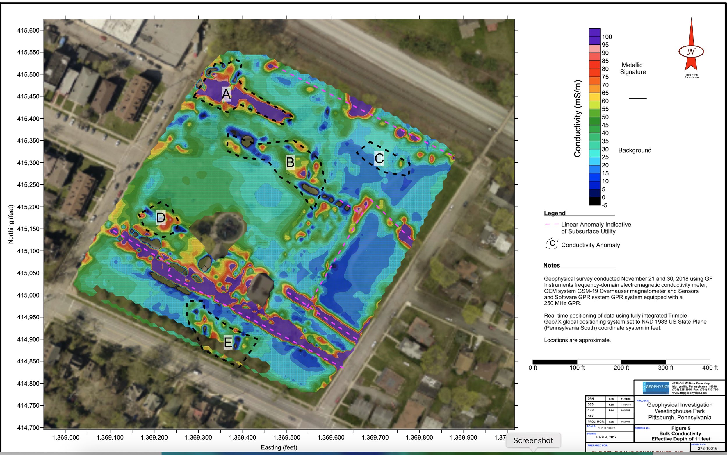
Here’s a close-up detail of the image showing where the Solitude mansion stood, in the right center of the map.

Image of Solitude foundation for 2019 GPR Survey
In 2024, teams from the University of Pittsburgh’s Department of Anthropology and Archeology, under the direction of professors Bryan Hanks, Claire Ebert, and Jennifer Muller, started to survey the park in greater detail, setting up a grid of one meter squares and using both ground penetrating radar and electric conductivity equipment. Below is a GPR image of the same area shown above, revealing the more clearly defined basement of the mansion.

Image of Solitude foundation from 2024 Pitt GPR study
Here’s an image of the same area as shown by electromagnetic conductance equipment.
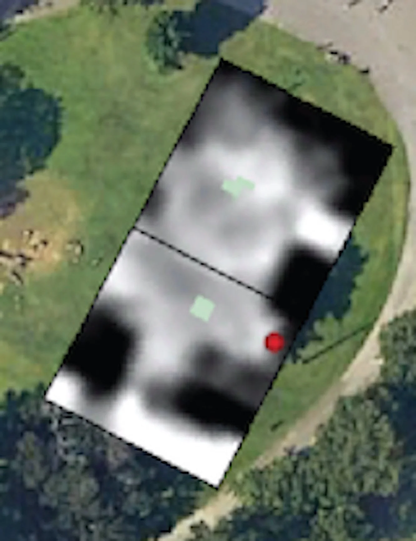
Image of Solitude foundation in 2024 Pitt Survey using Electromagnetic Conductance